Join us as we go trail running in Marin, California to experience mountains, wildflowers, Redwood trees and the Pacific Ocean all in one short run.
Trail running in Marin, California
For the run featured in tis video, we take the following route:
From the Mount Tamalpais Watershed HQ and Bon Tempe Reservoir, we take the Rocky Ridge Road trail skyward, ascending the north side of the mountain. We eventually reach Rock Springs Lagunitas Road and then join Laurel Dell Fire Road.
Check out the short trail running film we made during this particular run. It gives you a flavor of what it’s like to go trail running in Marin, California, in the Spring.
If you enjoyed this short running film, be sure to subscribe to our YouTube Channel for more trail running films, gear reviews and advice!
After some time we hit Ridge Crest Boulevard, which is another good location for parking should you wish to explore trails starting from a higher point and overlooking the Pacific Ocean.
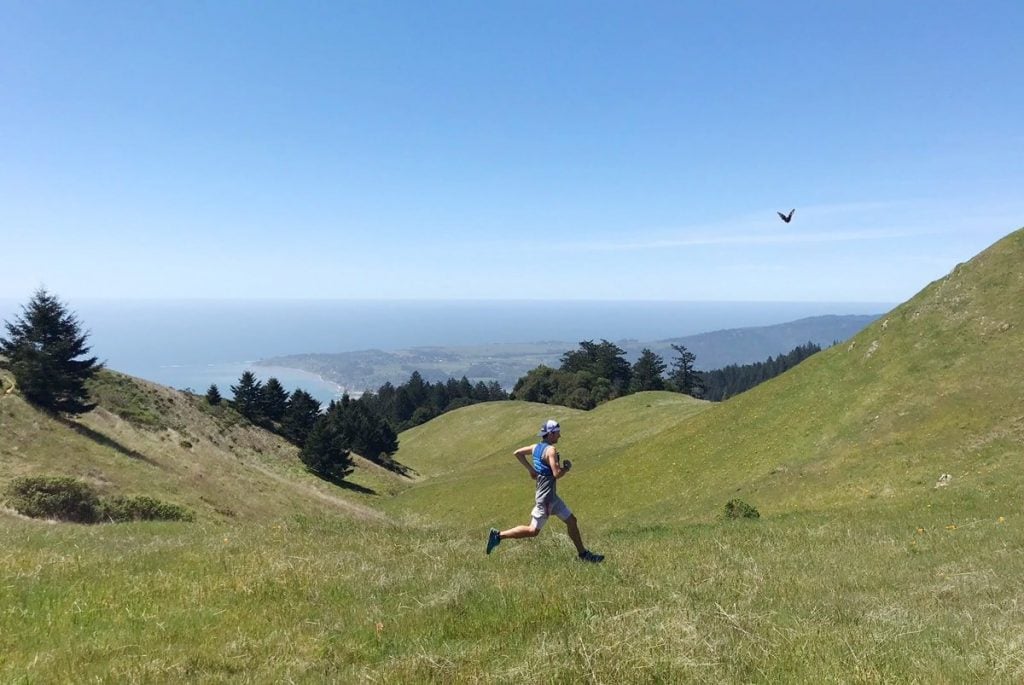
It is absolutely stunning up there with 360 degree views of Marin, including Stinson Beach, Mount Tamalpais and San Francisco City if you look to the horizon. Trail running in Marin is certainly something special!

![The Best Trail Running Shoes [2024]](https://www.trailandkale.com/wp-content/uploads/2024/02/best-trail-running-shoes-Trail-and-Kale-Recommends-2024-110x75.webp "The Best Trail Running Shoes [2024]")
Running and hiking the Cateract Trail, Marin California
The Cateract Trail is busier with some adventurous tourists looking to take in the beautiful Cateract Falls. The trail, in this direction, is a steady downhill run or hike on a single track trail, so get ready to deal with oncoming tourist traffic around the blind corners. Eventually, we made a right turn onto Helen Market Trail which continues down to Alpine Lake, running beside the water. The trail then split and we took Kent Trail all the way back to Bon Tempe Lake. Scroll down to see our Strava activity which shows our complete route with elevation and distance data.
Another fantastic day on the trails but isn’t every day a good day when spent outdoors?
RELATED: Beginner’s Guide To Trail Running: Keeping It Fun & Simple
Filmed Using:
Featured Gear:
- Trail & Kale Classic Trail Running Trucker Hat – (Alastair)
- Inov-8 Trailroc 285 – (Alastair)
- Inov-8 Trailroc 285 Women’s – (Helen)
- Suunto Spartan Sport Wrist HR Baro
- Nathan Speed – (Alastair)
- Nathan Speedster – (Helen)
- Salomon Skirt – (Helen)
Thanks for watching, please like this video if you enjoyed it, and subscribe to our YouTube channel for more trail running related videos.
Strava Activity in case you would like to go trail running or hike the same route:
And don’t forget to join our Strava Run Club whilst you’re there 🙂
You may also like:
- Up and down Mount Tamalpais – Trail Running in Marin California
- Our review of the Inov-8 Trailtalon 235 trail running shoes worn in this video.
- Tennessee Valley Beach Trail Run, Marin California
- Trail Running in Mount Tamalpais State Park, California
- Trail Running in Marin California
- What To Pack For Trail Running: Essentials To Carry
- What To Wear Trail Running: Essential Trail Running Clothing